
-
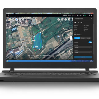
DJI Terra – Agriculture Version, 1 Year
DJI Terra – Agriculture Version, 1 Year Capture, analyze and visualize your environment with DJI Terra – an intuitive, PC-based mapping software developed to help industry professionals transform real-world scenarios into digital assets. * Flight Planning: simply select an area on the map to create flight paths and automate complex missions. Waypoint Mission Planning: create […]
-

Virtual Surveyor
Virtual Surveyor TOPOGRAPHIC SURVEYING Create lightweight CAD models from your drone data SURVEY CURB AND GUTTER Combine field measurements with your drone data to model curbs. Survey the back of the curb from your drone data. Model the rest of curb using offset tools and field measurements. Then complete with quick editing tools. ROAD SURVEYS […]