
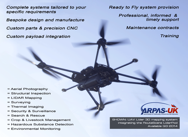
Nowdays, while aerial photography and aerial filming has reached its own level, we look forward to various industries with industrial drones. In co-operation with our partner as manufacturer VulcanUAV, we can now assist you in various fields. Such as: structural and infrastructure inspection, lidar mapping, thermal imaging, search and rescue, crop and livestock management, hazardous substance detection, surveying, environmental monitoring and more.
Meeting your requirements may simply involve integrating the payload or sensor of choice into a standard aircraft system but, as applications vary, we often need to go further. We are able to produce whatever is needed to optimise fully your system for your particular application, from custom short run or prototype parts to a complete bespoke system designed from the ground up.
Our aim is to see that you get what you need to accomplish effectively the task at hand and we will work closely with you to ensure this is the case.
LIDAR MAPPING | THERMAL IMAGING | CROP & FORESTRY SURVEY
Industrial drones @ Professional-Multirotors.com:
www.professional-multirotors.com/industrial-drones
For more: info (at) professional-multirotors.com