
 |
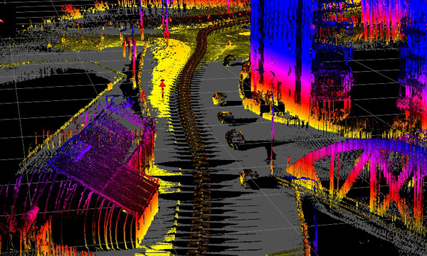
UAV & drone 3D Lidar mapping uses lasers to accurately measure the range from the sensor to points on an object or on the ground. Using multiple lasers at high speed allows a huge amount of data to be collected very quickly. Then using information from a highly accurate IMU to measure the attitude of the aircraft when each piece of data is collected, as well as an RTK GPS system, an extremely detailed 3D map can be created of any object or area. Post process correlation of IMU and GPS data, can then geo reference this data to an accuracy of a few millimetres. This truely disruptive technology will see fundamental changes in the way much of surveying is done in the very near future. |
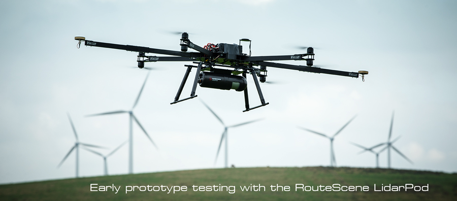
Vulcan UAV are the preferred supplier of UAVs for the new LidarPod from RouteScene. They have been working closely with them since December 2013 to develop a system optimised for Lidar 3D mapping using their ground breaking technology. At a mere 2.5 Kgs, the LidarPod is by far the smallest and most compact fully integrated Lidar scanner for use on UAVs, vehicles and any other mobile platform.
The LidarPod includes the Velodyne HDL32 lidar scanner which uses 32 lasers collects over 700,000 distance measurements per second. This is then integrated with a highly accurate comprehensive INS solution, an RTK GPS system (which uses additional GPS antennas on the UAV for ultra accurate heading reference), on board data storage, and a two way data link for RTK GPS updates and data verification. The system also comes with RouteScene’s own data viewer and filtration software.
 LIDAR MAPPING | THERMAL IMAGING | CROP & FORESTRY SURVEY
Industrial drones @ Professional-Multirotors.com:
www.professional-multirotors.com/industrial-drones
For more: info (at) professional-multirotors.com